|
Periodic Coverage Analysis Module
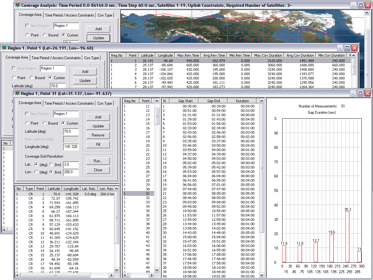
The Periodic Coverage Analysis module allows you to undertake statistical analyses of visibility intervals for user-defined geographical regions. You can supply the exact locations of points and specify latitude bounds, or you can use the 2D map to define custom regions. The module determines visibility intervals for each point of the coverage grid and creates an interactive report that shows the revisit time (max/min, average), coverage time, number of gaps, and total coverage duration (%) measured over the entire simulation interval, etc. You can determine visibility intervals when the specified number of satellites is available to grid points. The results can be grouped by latitude and by region. The report includes a histogram showing the distribution of durations of visibility intervals (or gaps) for a selected set of points. |
|
||||||||||
|
Continuous Coverage Analysis Module
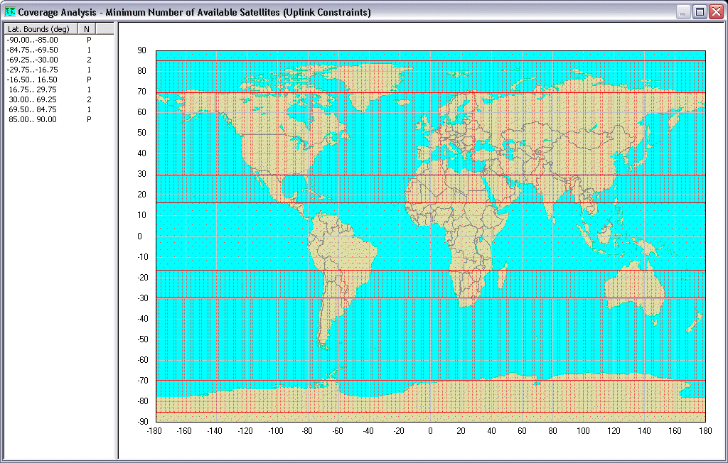
The Continuous Coverage Analysis module allows you to determine, for a given constellation, the minimum number of satellites that will be available at all times to each point at given latitudes. An analyzed constellation can include any combination of satellites or groups of satellites with the same orbit altitude and inclination. Each such subconstellation can be analyzed separately. You can specify individual access constraints for any group of satellites. The module generates the Coverage by Latitude tabular report and displays the results of analyses on a world map, with graphics depicting the various levels of coverage. |
|
||||||||||
|
Constraints Analysis Module
The Constraints Analysis module allows you to determine latitude-dependent values of the minimum ground elevation angle, maximum satellite sensor's field-of-view, and maximum ground station to satellite propagation range, all of which have to be maintained by the generated constellation to provide the desired type of continuous coverage (single, double, triple, etc.) at specified latitudes. |

|
||||||||||
|
|
|||||||||||